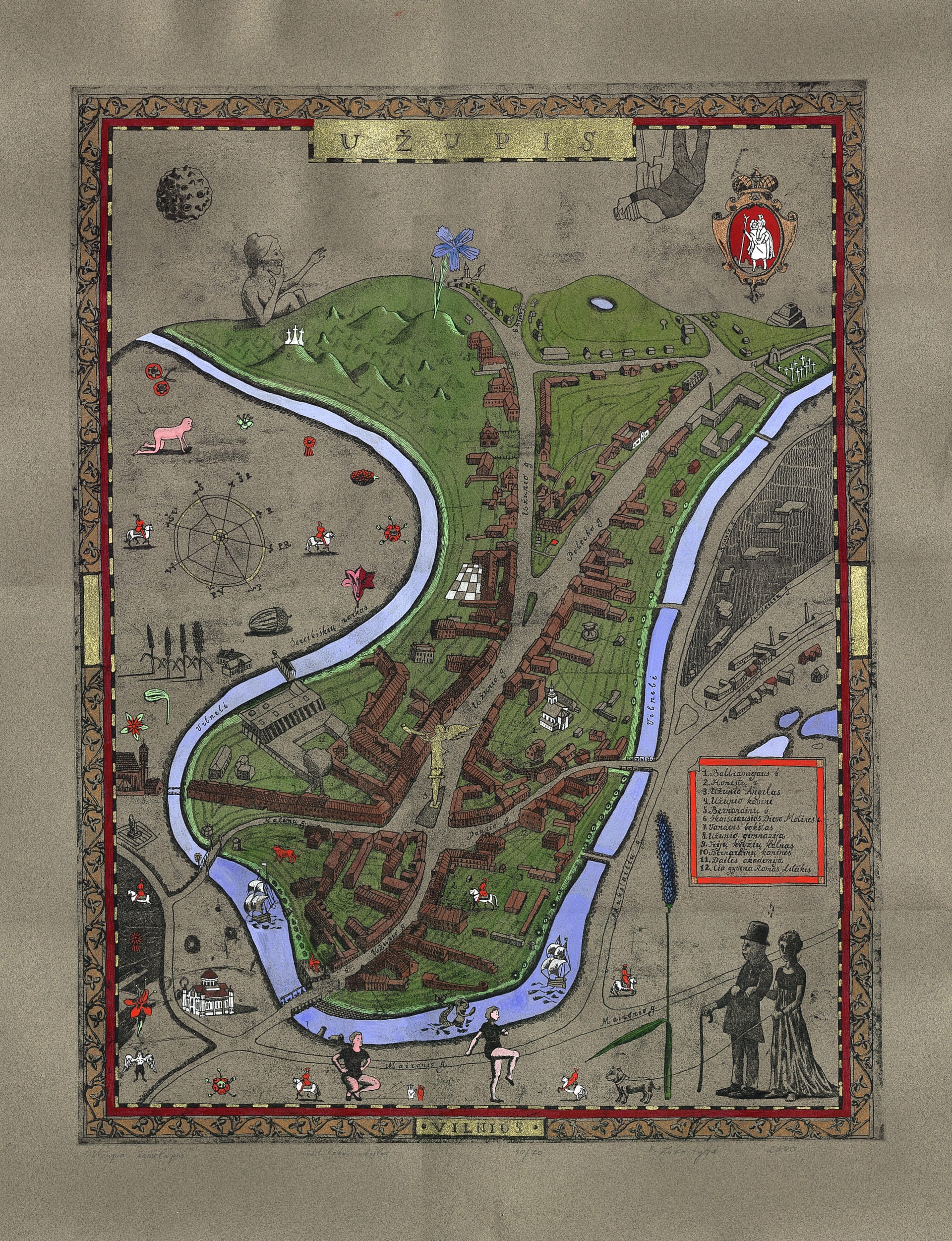
Map: Real Geography and Artistic Fantasy
The territory and boundaries of Užupis: the Vilnelė on three sides and hills on the fourth. Official map, front and back, and artists' maps of the Republic.
Credits: Užupis photo archive
Map: Real Geography and Artistic Fantasy
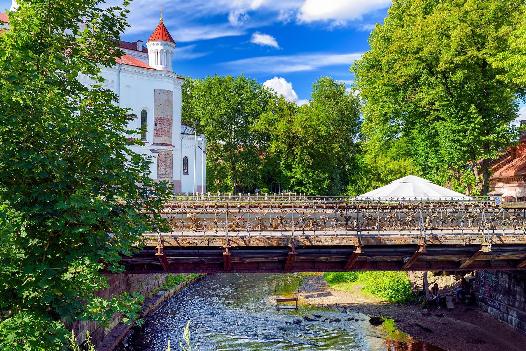
Užupis is easy to outline and easy to love: on three sides it is encircled by the Vilnelė, and on the fourth it is bordered by hills that belong to Kalnų Park. Because of these natural borders, the suburb remained relatively enclosed for centuries and kept its particular character. You feel it immediately when walking: you cross a bridge - and the rhythm changes.
Užupis map
Key places, bridges and useful starting points for a walk in one interactive map.
Borders and Streets
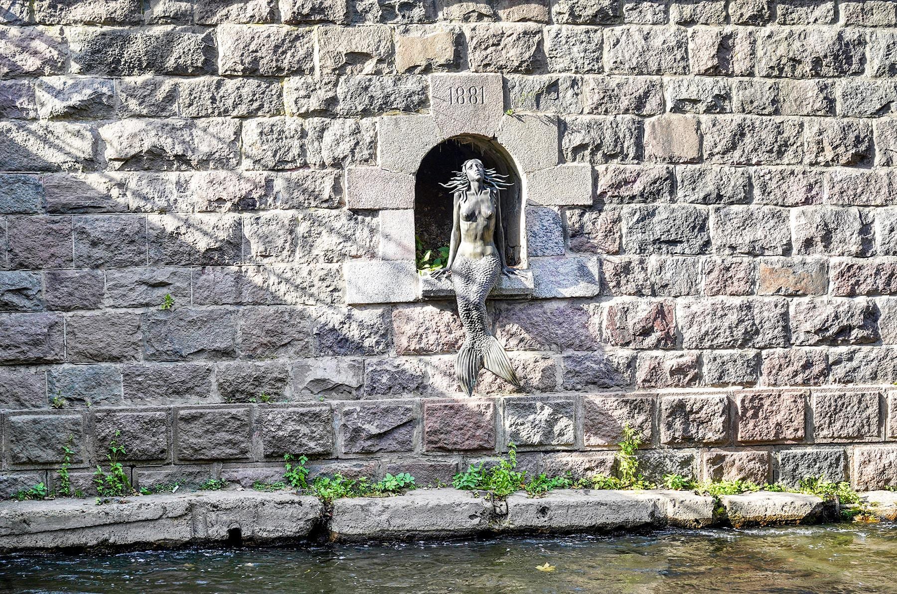
The main streets of Užupis are Užupio, Filaretų, Polocko, Krivių, Žvirgždyno, Malūnų and Paupio. The built fabric is denser near the Old Town and becomes looser farther from the centre, turning into hills and greenery. The Vilnelė is not background here but the main actor: the cafe terrace stands beside it, the mermaid sits on its embankment and nine bridges cross it.
Official Map
The Republic has its own map - front and back, prepared for print. It is available as PDF and will be added for viewing and download. The map marks not only streets, but also places important to the Republic: the Angel, the Constitution Wall, bridges and border posts.
Artistic Maps
Užupis deserves not only an accurate map but an artistic one. Over the years, artists' maps of the Republic have accumulated, where geography freely mixes with mythology - the metro line to Žvėrynas, the "centre of the province of the universe", border markers that cannot be found on any official plan. These maps will be gathered into a separate gallery: they are works of Užupis in themselves.
Further work: add an interactive map with marked places to visit and border posts; digitise and describe artistic maps with authors and years; add a walking route with an estimated duration.